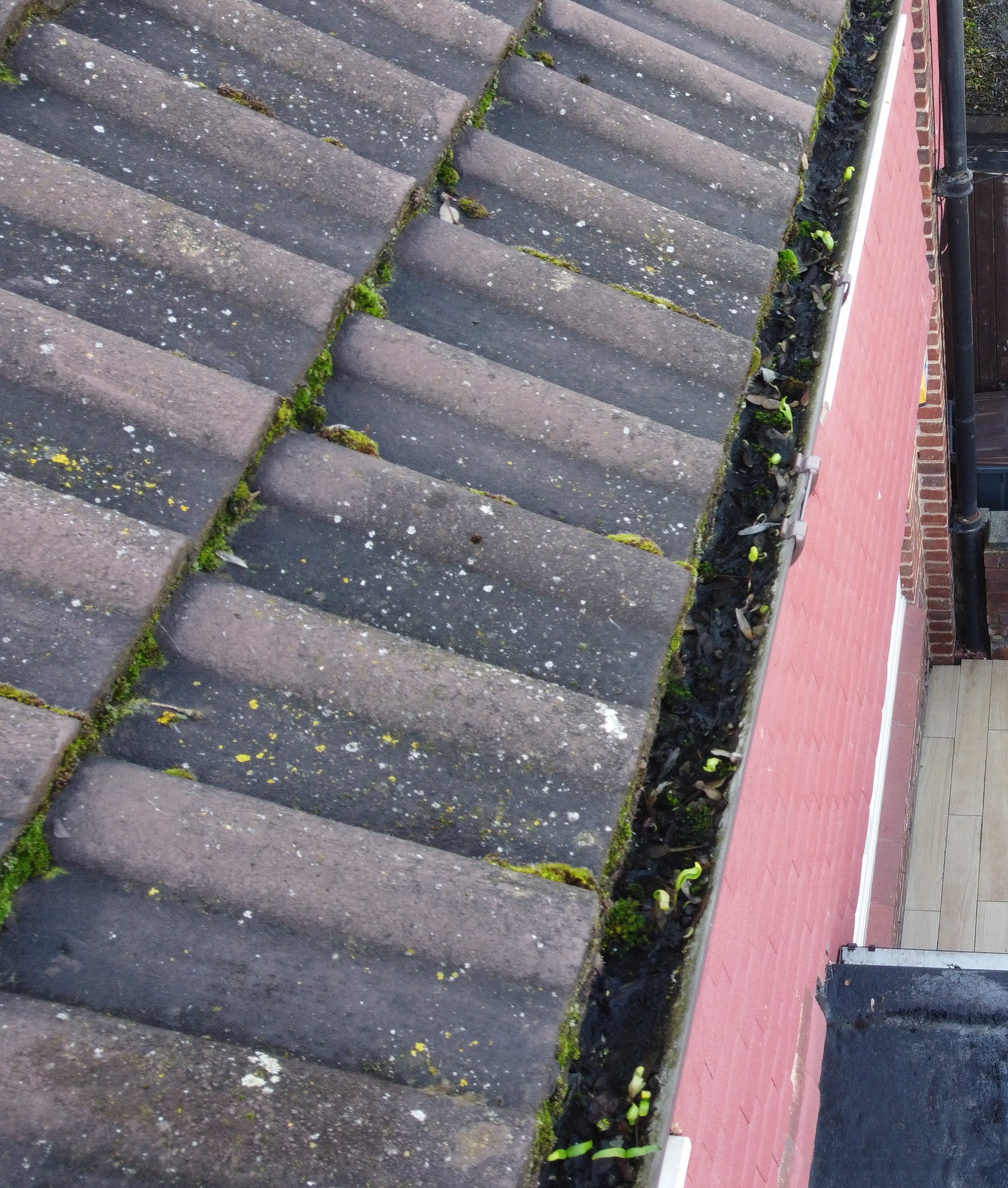
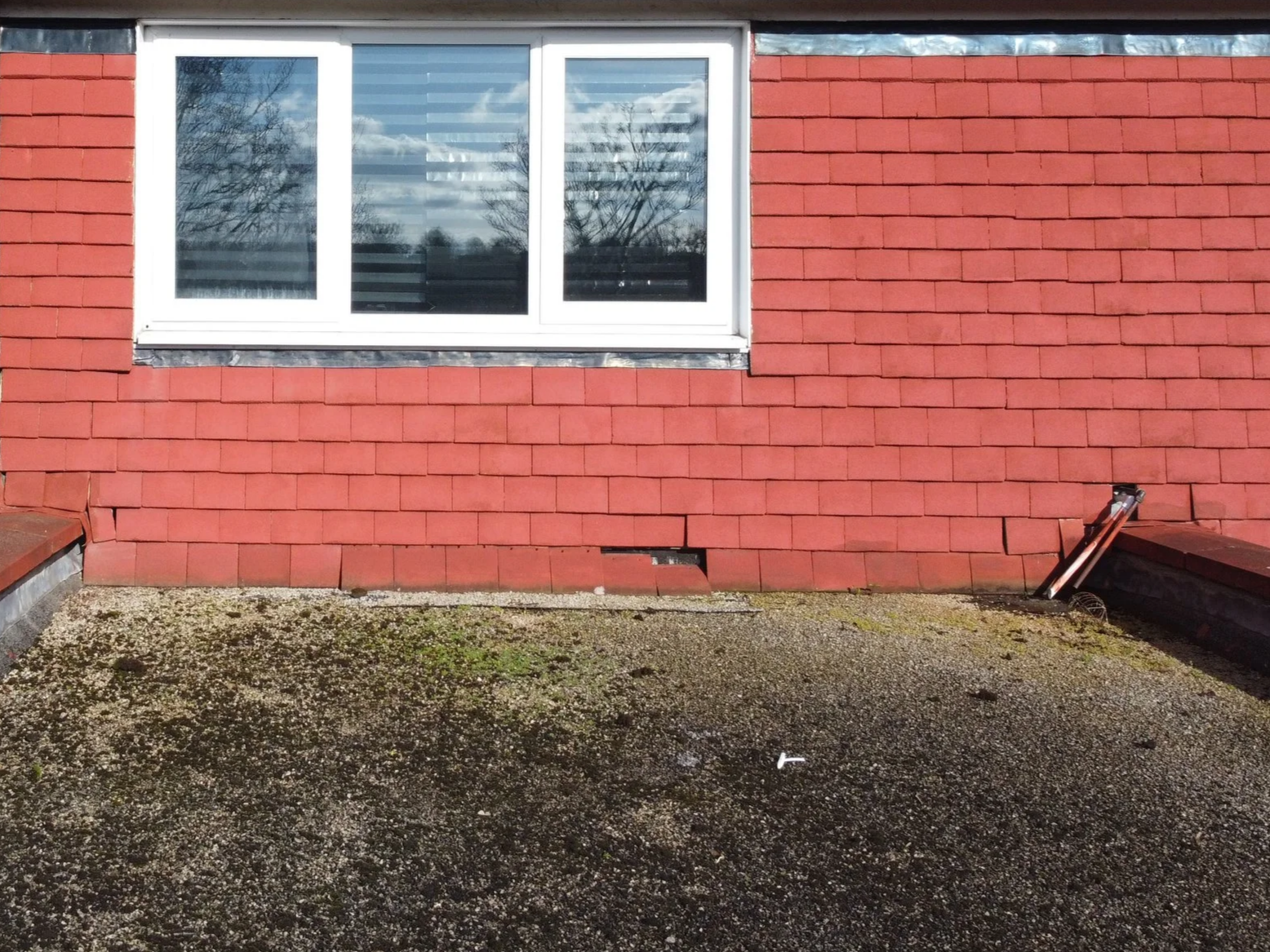
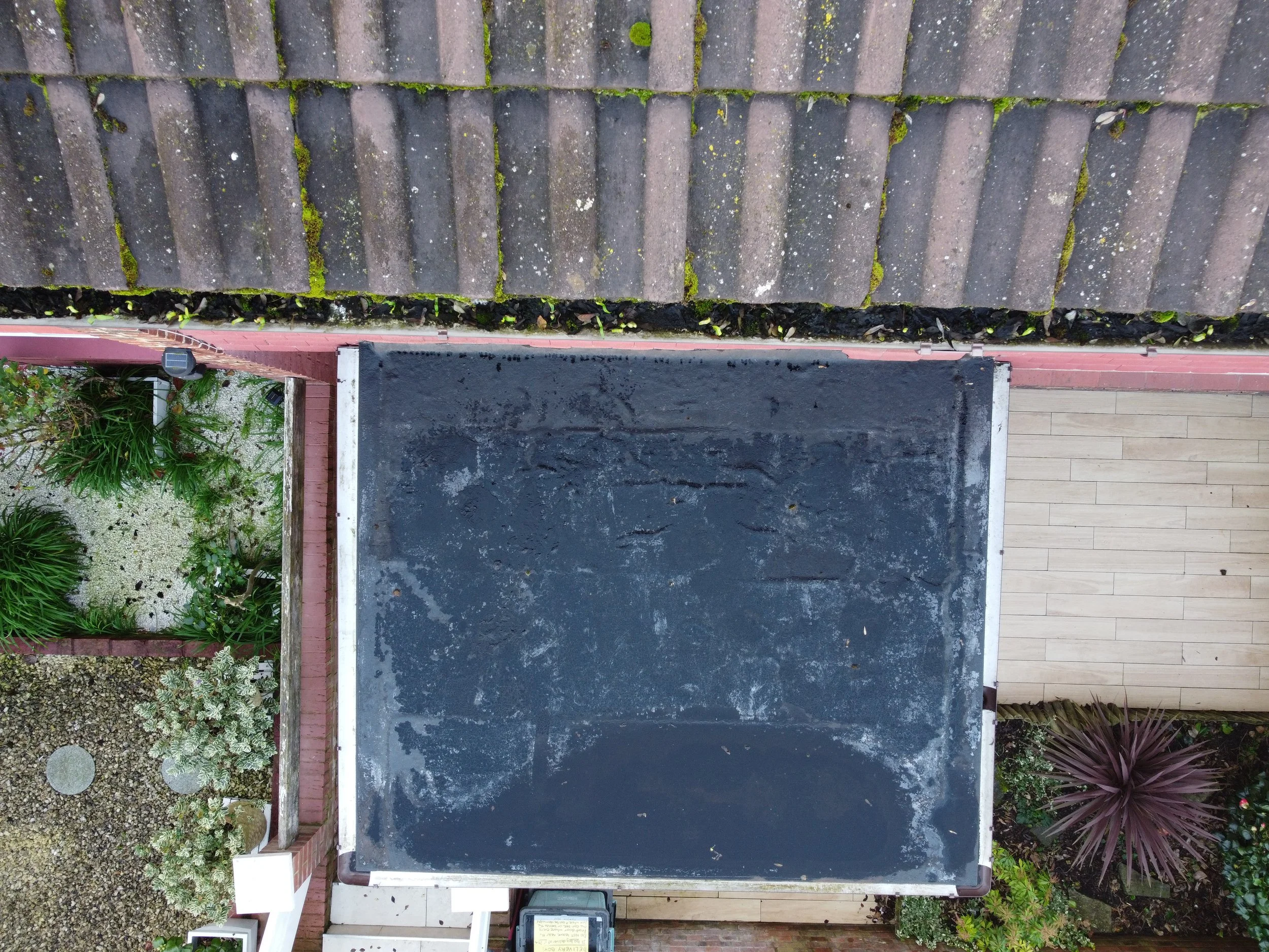
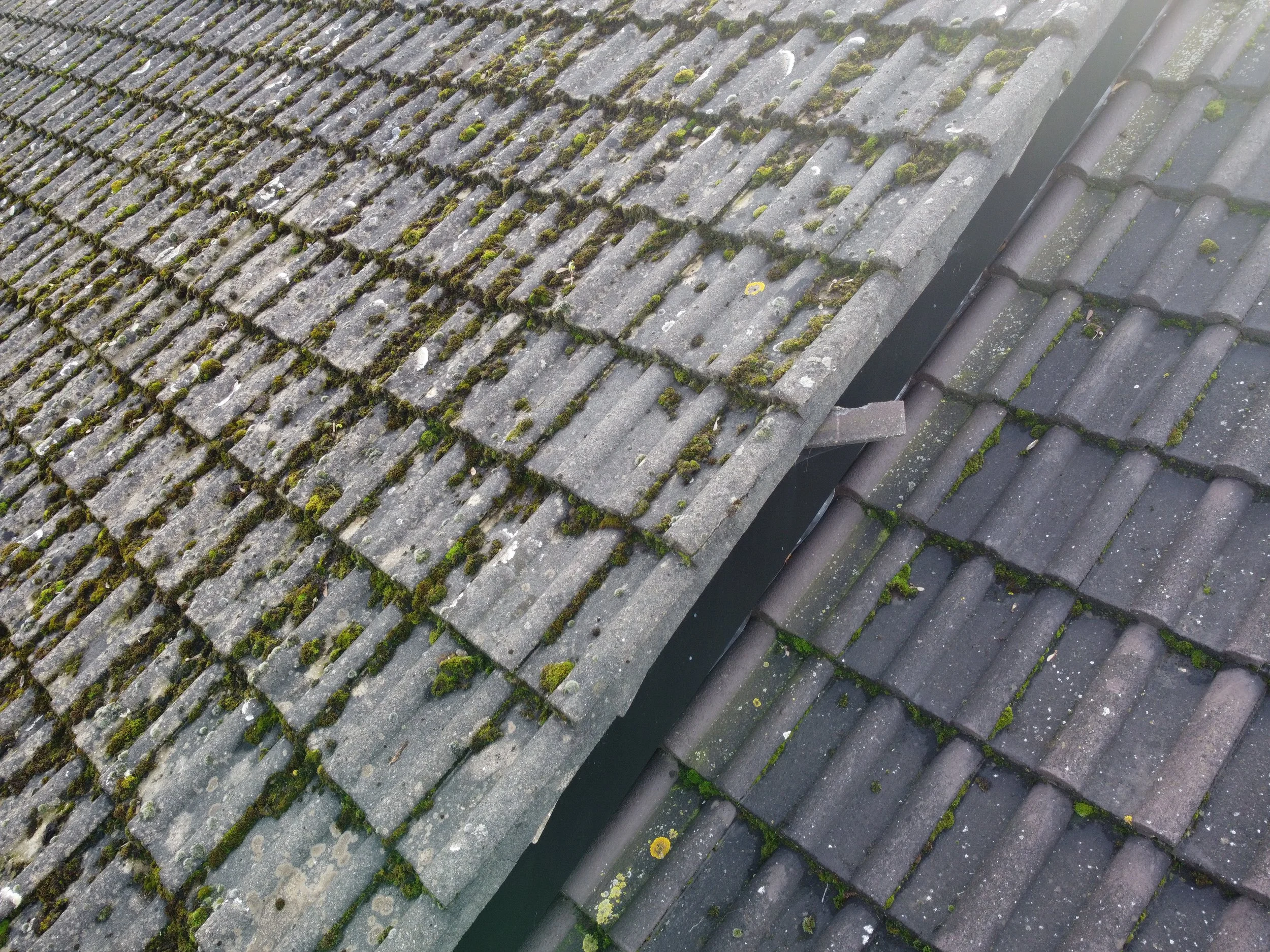
✔ Full roofline & gutter visibility
✔ Identification of visible blockages or damage
✔ No ladders or scaffolding required
✔ Clear visuals of reported areas
✔ Fast on-site capture (weather permitting)
✔ Fully insured & CAA-authorised operators
✔ Secure delivery within 24hrs
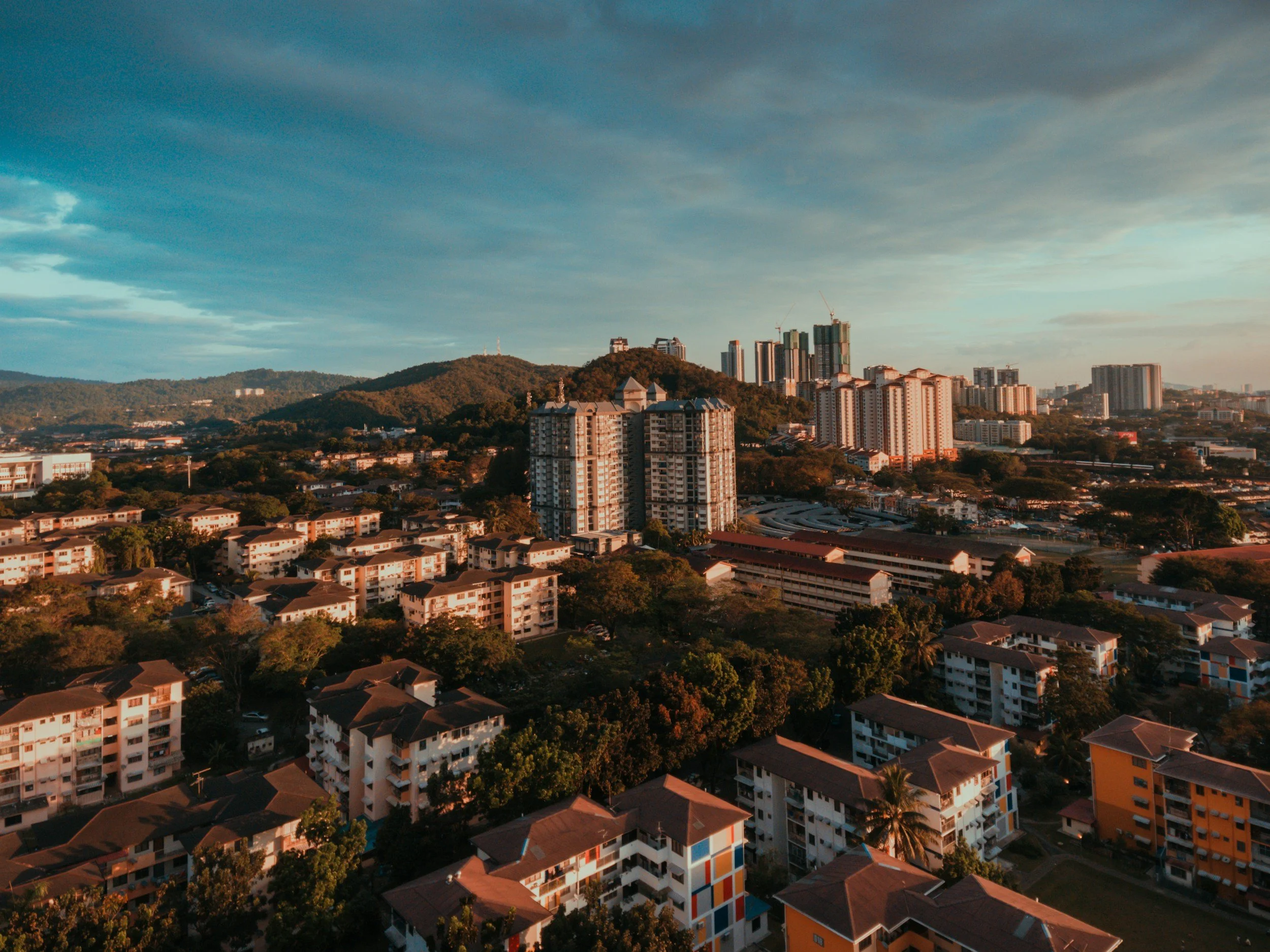
High-resolution aerial imagery and videography for homeowners, insurers, landlords, and property professionals.
Drone Roof & Property Documentation
Starting from £120
View a Sample Inspection Report (PDF)
Reports are provided for visual documentation purposes only and are not a substitute for a full structural survey.

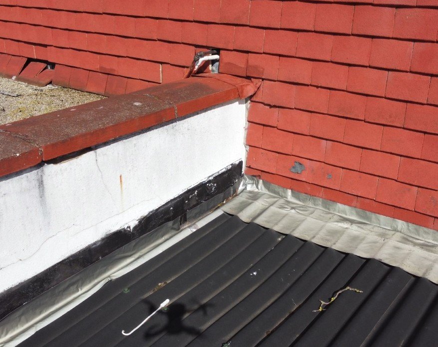

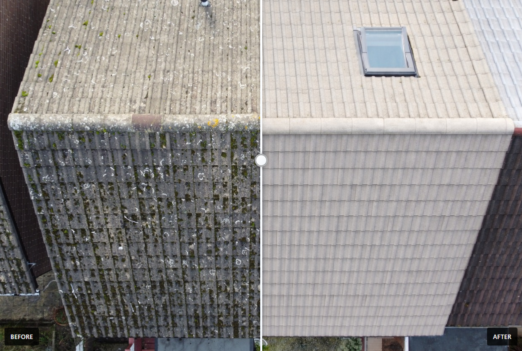

PROPERTY & ROOF INSPECTIONS
Perfect for homeowners, contractors, and insurance documentation
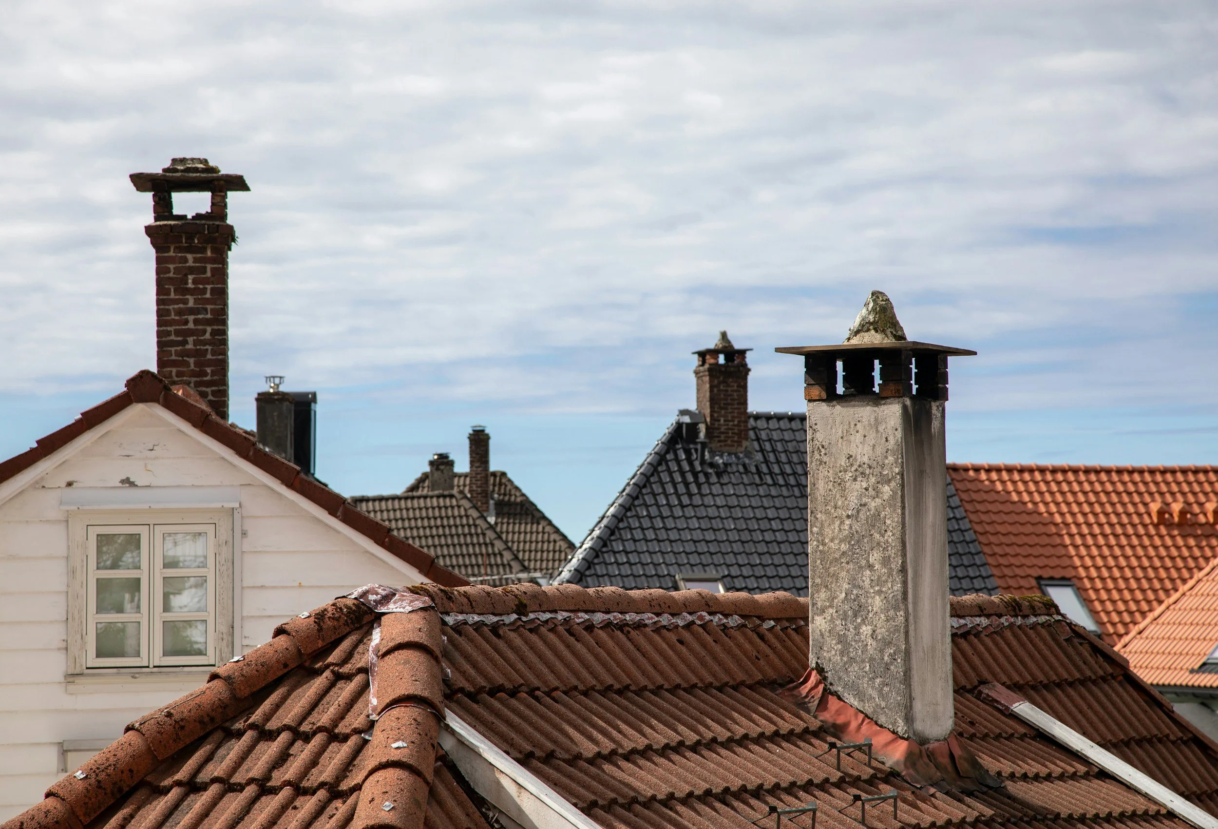
High-resolution aerial photos of roofs, chimneys, gutters, and hard-to-reach areas
Safe, contact-free inspections without ladders or scaffolding
Ideal for condition checks, damage evidence, and maintenance planning
Clear images suitable for sharing with insurers or tradespeople
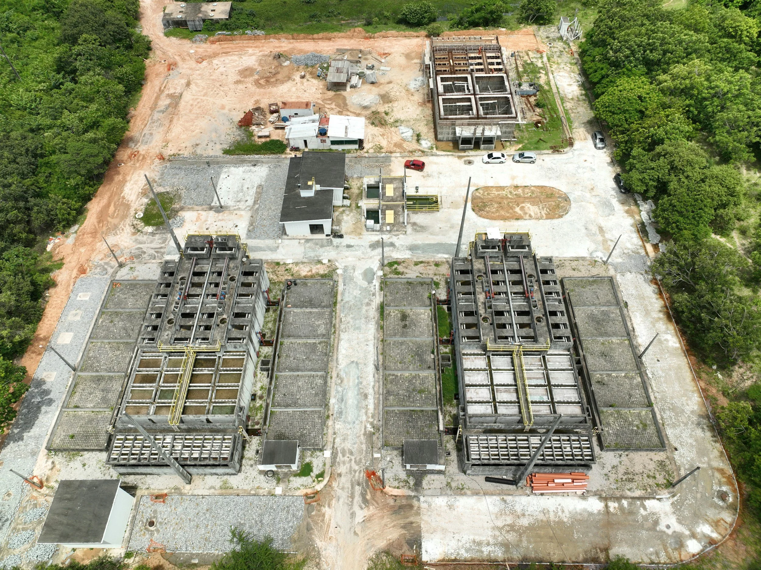
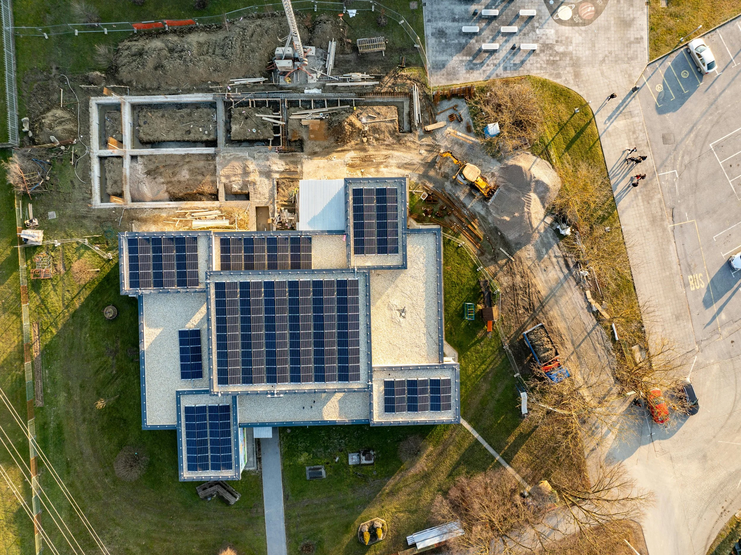
CONSTRUCTION AND SITE PROGRESS MONITORING
Visual progress tracking from start to finish
Before, during, and after aerial photography
Regular progress shots from consistent angles
Ideal for contractors, developers, and project managers
Helps document workmanship, timelines, and site layout
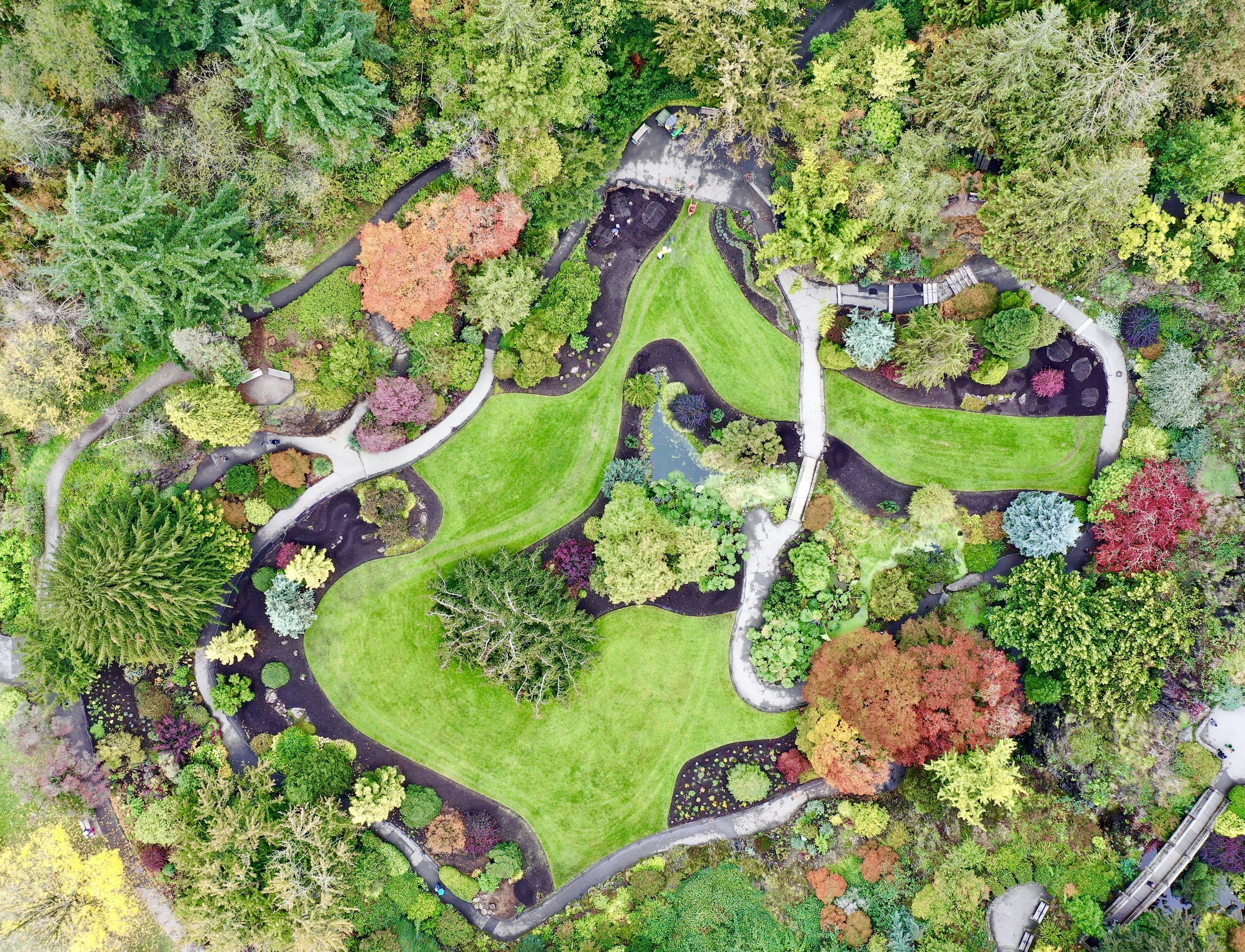
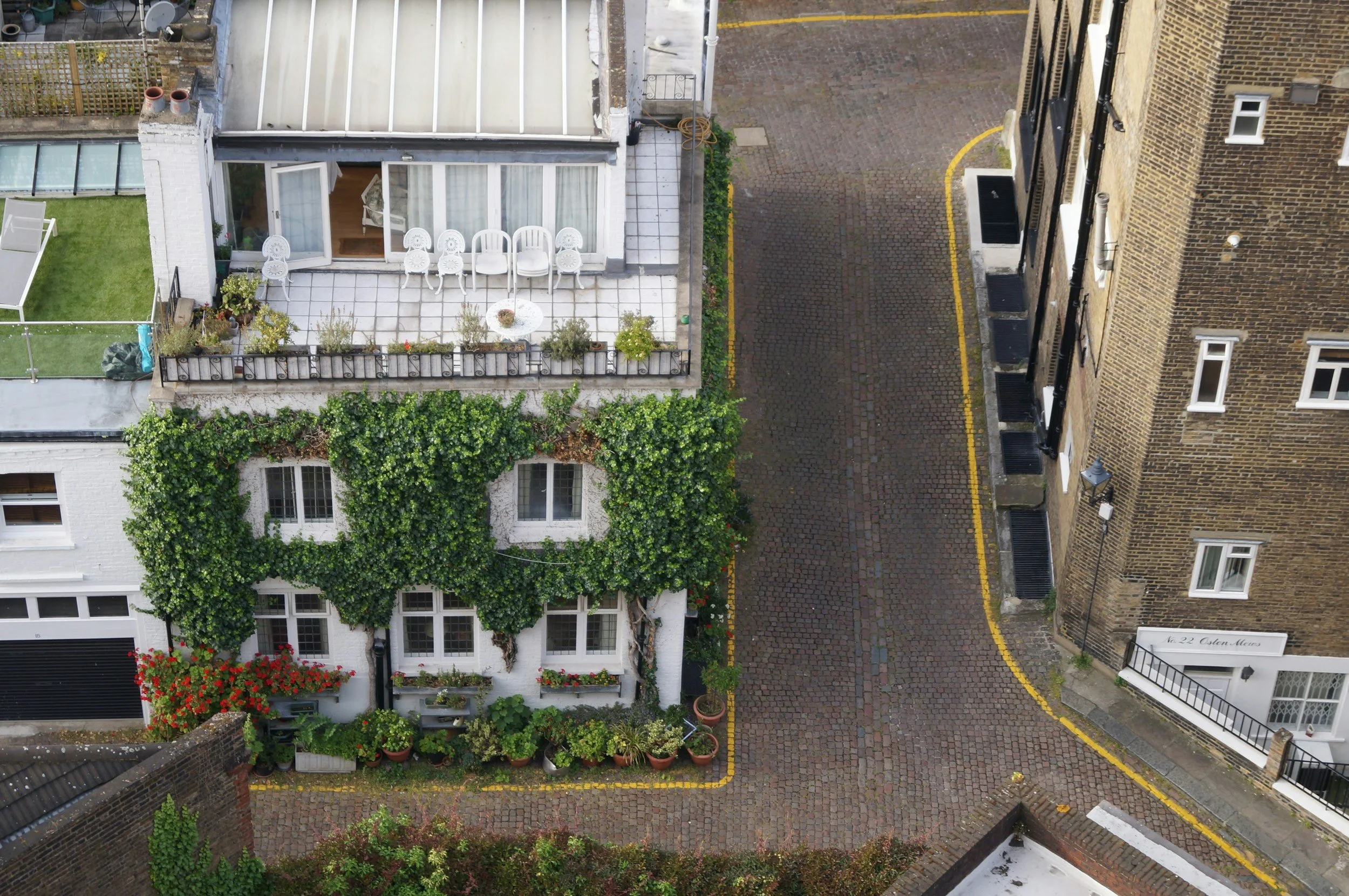
LAND, GARDEN & PROPERTY OVERVIEWS
Show the full picture from above
Top-down and angled aerial views of land and gardens
Perfect for boundary visuals, landscaping projects, and planning
Useful for homeowners, landlords, and small developers
Great for “before & after” comparisons

PROPERTY MARKETING (ESTATE AGENTS)
Make listings stand out instantly
Eye-catching aerial photos of homes and surrounding land
Show property scale, plot size, and location clearly
Optional short aerial video clips for listings and social media
Helps attract more attention and higher-quality enquiries
AERIAL PHOTOGRAPHY & VIDEOGRAPHY
Clean, professional aerial visuals for multiple uses
High-quality still images and smooth video footage
Ideal for marketing, documentation, and personal projects
Filmed safely, legally, and professionally
Edited and delivered in web-ready formats
Operating Area
We currently operate in South London, however we are willing to travel to locations in surrounding areas if need be.
Contact Us
Have a property, roof, garden or project that needs visual documentation?
Send us a message, and we’ll provide independent, time-stamped imagery to support your decision-making. Whether it’s a single site or multiple locations, we’re ready to create repeatable, objective visual records for your project.
FAQs: Professional Aerial Documentation for Properties in South East London
-
TopDrone provides professional aerial photography and video documentation using drones. This includes high-resolution images of roofs, buildings, land, and structures for record-keeping, insurance, maintenance planning, marketing, and visual reference.
-
Our services are commonly used by:
Homeowners
Landlords and property managers
Roofing contractors and inspectors
Insurance professionals
Estate agents and developers
Maintenance and facilities teams
-
Yes. All flights are conducted in line with UK Civil Aviation Authority (CAA) regulations, with safety, privacy, and professionalism as a priority.
-
In most cases, no. As long as access and permission are confirmed in advance, flights can usually be completed without the property being occupied.
-
Most residential aerial documentation jobs take 30–60 minutes on site, depending on property size, access, and weather conditions.
-
You’ll receive your files digitally, via a secure download link. Images are delivered in high resolution and ready for professional use.
-
Yes. You can request targeted coverage of specific areas (for example: chimney stacks, gutters, flat roofs, extensions, or elevations).
-
TopDrone operates across South East London and surrounding areas.
If you’re unsure whether your location is covered, just get in touch. -
Yes. For safety and image quality, flights may be rescheduled due to high winds, heavy rain, or poor visibility. We’ll always communicate clearly if weather causes a delay.
-
Please contact us directly — and we’ll respond promptly to discuss your requirements and arrange a suitable time and date.